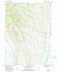
1967 Map of Marse
USGS Topo · Published 1991About this map
The Sublette Range dominates this mid-century western landscape, where the high ridges and deep canyons of Lincoln County meet the irrigation networks of the valley floors. In the southwest, the Bear River winds through The Narrows, passing the small settlement of Marse, which sits near a significant local elevation point at BM 6118. The map documents a complex system of water management, evidenced by the Stoner Nelson Wheelock Ditch, Emelle Ditch, and Partridge Ditch that draw from the Smiths Fork to support ranching and agriculture.
Find a feature on this map
37 named features on this map. Tap any name to fly to it.
Don’t see what you’re looking for? This feature index may not catch every label — zoom into the map to look around manually.
Map Details
Editions of this 1967 Marse Map
2 editions found
Other maps of this area

1909 · Montpelier
USGS Topo · 1:125,000

1911 · Montpelier
USGS Topo · 1:125,000

1936 · Cokeville
USGS Topo · 1:96,000

1942 · Cokeville
USGS Topo · 1:125,000

1955 · Preston
USGS Topo · 1:250,000

1958 · Preston
USGS Topo · 1:250,000

1962 · Preston
USGS Topo · 1:250,000

1967 · Big Park
USGS Topo · 1:24,000

1967 · Huff Lake
USGS Topo · 1:24,000
1967 · Sublette Canyon
USGS Topo · 1:24,000