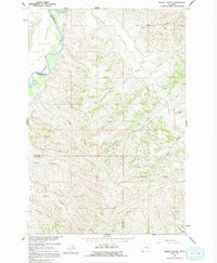
1960 Map of Marsh Coulee
USGS Topo · Published 1992About this map
Bighorn River flows through the northwest corner of this quadrangle, defining the fertile plains of Big Horn Bottom. In 1960, the landscape was primarily shaped by water management for agriculture, as evidenced by the Bighorn Tullock Ditch and Victory Ditch tracing the valley floor. Away from the river, the terrain rises into a complex network of dry coulees and creek forks, including Marsh Coulee and Nelson Coulee, which drain the uplands toward Tullock Creek.
Find a feature on this map
27 named features on this map. Tap any name to fly to it.
Don’t see what you’re looking for? This feature index may not catch every label — zoom into the map to look around manually.
Map Details
Editions of this 1960 Marsh Coulee Map
2 editions found

Other maps of this area

1894 · Fort Custer
USGS Topo · 1:125,000

1954 · Hardin
USGS Topo · 1:250,000

1954 · Forsyth
USGS Topo · 1:250,000

1957 · Hardin
USGS Topo · 1:250,000

1957 · Forsyth
USGS Topo · 1:250,000

1958 · Forsyth
USGS Topo · 1:250,000

1958 · Hardin
USGS Topo · 1:250,000

1960 · Bighorn
USGS Topo · 1:24,000

1960 · Foster
USGS Topo · 1:24,000

1960 · Custer
USGS Topo · 1:24,000