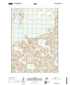
2020 Map of Marshall A-5 NE
USGS Topo · Published 2020About this map
Aropuk Lake dominates the central portion of this remote Alaskan terrain, its irregular shoreline reflecting a landscape defined by an intricate network of wetlands and tundra. Located within the Bethel Census Area, the region exhibits the classic hydrologic patterns of the Yukon-Kuskokwim Delta, where water and land exist in a fluid, seasonal balance. The Izaviknek River meanders across the northeastern corner, its winding course serving as a primary corridor through a wilderness largely devoid of permanent human infrastructure. This survey illustrates the isolation of the western interior, focusing on the natural geography and the complex aquatic systems that have shaped the subsistence and travel patterns of the region for generations.
Find a feature on this map
6 named features on this map. Tap any name to fly to it.
Don’t see what you’re looking for? This feature index may not catch every label — zoom into the map to look around manually.
Map Details
Editions of this 2020 Marshall A-5 NE Map
This is the sole edition of this map. No revisions or reprints were ever made.
Other maps of this area

1951 · Marshall
USGS Topo · 1:250,000
1953 · Marshall A-5
USGS Topo · 1:63,360

1953 · Marshall B-5
USGS Topo · 1:63,360

1954 · Marshall B-4
USGS Topo · 1:63,360
1954 · Marshall A-4
USGS Topo · 1:63,360

1954 · Marshall
USGS Topo · 1:250,000
2020 · Marshall B-4 SW
USGS Topo · 1:25,000
2020 · Marshall A-5 NW
USGS Topo · 1:25,000
2020 · Marshall A-5 SE
USGS Topo · 1:25,000
2020 · Marshall B-5 SE
USGS Topo · 1:25,000