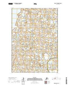
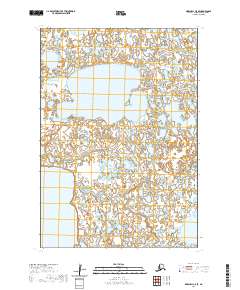
2020 Map of Marshall B-5 NE
USGS Topo · Published 2020About this map
Kgun Lake sits in the northwest corner of this remote landscape within the Kusilvak Census Area, where a dense network of water and wetlands defines the terrain. The map documents an intricate mosaic of small unnamed lakes and tundra ponds that dominate the delta-like environment near the boundary with the Bethel Census Area. This 2020 survey illustrates the hydrography of the region in fine detail, revealing the complex drainage patterns and natural water storage typical of this part of Alaska. While no settlements or roads are recorded, the land is meticulously subdivided into townships such as t16n r80w and t15n r80w, providing a precise grid for those studying land management and historical boundary lines in this northern wilderness.
Find a feature on this map
6 named features on this map. Tap any name to fly to it.
Don’t see what you’re looking for? This feature index may not catch every label — zoom into the map to look around manually.
Map Details
Editions of this 2020 Marshall B-5 NE Map
This is the sole edition of this map. No revisions or reprints were ever made.
Other maps of this area

1951 · Marshall
USGS Topo · 1:250,000

1952 · Marshall C-5
USGS Topo · 1:63,360

1953 · Marshall B-5
USGS Topo · 1:63,360

1954 · Marshall B-4
USGS Topo · 1:63,360

1954 · Marshall C-4
USGS Topo · 1:63,360

1954 · Marshall
USGS Topo · 1:250,000
2020 · Marshall B-4 NW
USGS Topo · 1:25,000
2020 · Marshall B-4 SW
USGS Topo · 1:25,000
2020 · Marshall B-5 NW
USGS Topo · 1:25,000
2020 · Marshall C-5 SE
USGS Topo · 1:25,000