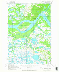
1952 Map of Marshall D-3
USGS Topo · Published 1966About this map
The Pilot Station settlement overlooks a massive bend in the Yukon River, serving as a focal point for navigation in this intricate landscape of shifting channels and low-lying islands. Based on 1951 aerial photography, the map illustrates the complex hydrology of the region, where the Chuilnak River feeds into the main Yukon flow while Hills Slough and Kashunuk Slough carve secondary paths through the delta. Large features like Hills Island and East Point anchor the river's course, surrounded by vast networks of seasonal waterways and tundra ponds.
Find a feature on this map
11 named features on this map. Tap any name to fly to it.
Don’t see what you’re looking for? This feature index may not catch every label — zoom into the map to look around manually.
Map Details
Editions of this 1952 Marshall D-3 Map
2 editions found
Other maps of this area

1951 · Marshall
USGS Topo · 1:250,000

1952 · Kwiguk
USGS Topo · 1:250,000

1952 · Kwiguk A-2
USGS Topo · 1:63,360

1952 · Kwiguk A-3
USGS Topo · 1:63,360

1952 · Marshall D-4
USGS Topo · 1:63,360
1952 · Marshall D-2
USGS Topo · 1:63,360

1952 · Marshall D-3
USGS Topo · 1:63,360

1954 · Marshall C-3
USGS Topo · 1:63,360
1954 · Marshall C-2
USGS Topo · 1:63,360

1954 · Marshall C-4
USGS Topo · 1:63,360