
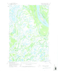
1952 Map of Marshall D-4
USGS Topo · Published 1964About this map
The Yukon River dominates the northeastern landscape of this mid-century survey, revealing a complex network of branching waterways and seasonal routes. The river's path is marked by large landforms such as Goose Island and the meandering Driftwood Slough, which weave through a low-lying terrain defined by countless ponds and smaller channels. To the south, the Kashunuk River carves its own intricate path, illustrating the fluid nature of the Alaskan interior where land and water frequently shift.
Find a feature on this map
6 named features on this map. Tap any name to fly to it.
Don’t see what you’re looking for? This feature index may not catch every label — zoom into the map to look around manually.
Map Details
Editions of this 1952 Marshall D-4 Map
2 editions found
Other maps of this area

1951 · Marshall
USGS Topo · 1:250,000

1952 · Kwiguk
USGS Topo · 1:250,000

1952 · Kwiguk A-4
USGS Topo · 1:63,360

1952 · Kwiguk A-3
USGS Topo · 1:63,360

1952 · Marshall D-5
USGS Topo · 1:63,360

1952 · Marshall C-5
USGS Topo · 1:63,360

1952 · Marshall D-3
USGS Topo · 1:63,360

1954 · Marshall C-3
USGS Topo · 1:63,360

1954 · Marshall C-4
USGS Topo · 1:63,360

1954 · Marshall
USGS Topo · 1:250,000