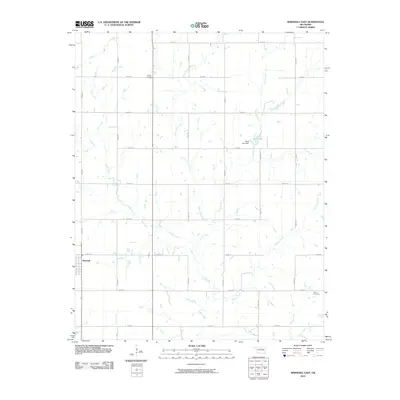
2010 Map of Marshall East
USGS Topo · Published 2010About this map
Marshall anchors the western edge of this Logan County landscape, situated at the junction of a modern section-line road network. The terrain is defined by a dense system of seasonal and perennial waterways that drain toward the south and east, including Otter Creek, Crows Nest Creek, and Elkhorn Creek. This drainage pattern influenced the early settlement of the region, as evidenced by the placement of local landmarks like the Shell Lake Dam and the impoundment of Shell Lake along Four-D Creek.
Find a feature on this map
27 named features on this map. Tap any name to fly to it.
Don’t see what you’re looking for? This feature index may not catch every label — zoom into the map to look around manually.
Map Details
Editions of this 2010 Marshall East Map
This is the sole edition of this map. No revisions or reprints were ever made.
Other maps of this area

1893 · Mulhall
USGS Topo · 1:62,500

1893 · Lovell
USGS Topo · 1:62,500

1955 · Enid
USGS Topo · 1:250,000

1956 · Garber
USGS Topo · 1:62,500

1958 · Enid
USGS Topo · 1:250,000

1972 · Lucien
USGS Topo · 1:24,000
1974 · Mulhall
USGS Topo · 1:24,000

1974 · Marshall West
USGS Topo · 1:24,000

1974 · Marshall East
USGS Topo · 1:24,000
1974 · Bridge Creek
USGS Topo · 1:24,000