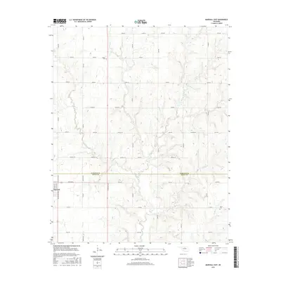
2016 Map of Marshall East
USGS Topo · Published 2016About this map
Marshall and the surrounding farmland of the Garfield and Logan county line are documented in this detailed 2016 survey. The area is defined by its section-line road network, including historic markers like Chisholm Rd and the Santa Fe corridor. Small communities and landmarks such as Bethel and Osborne are situated among the drainage basins of Otter Creek, Crows Nest Cr, and Elkhorn Cr. For family historians, the map includes the locations of Bethel Cem in the north and Bocox Cem in the southeast, providing precise geographic context for local burials. The landscape is a mix of agricultural plots and narrow wooded creek bottoms, with Shell Lake serving as a prominent water feature east of the N 3050 Rd axis.
Find a feature on this map
44 named features on this map. Tap any name to fly to it.
Don’t see what you’re looking for? This feature index may not catch every label — zoom into the map to look around manually.
Map Details
Editions of this 2016 Marshall East Map
This is the sole edition of this map. No revisions or reprints were ever made.
Other maps of this area

1893 · Mulhall
USGS Topo · 1:62,500

1893 · Lovell
USGS Topo · 1:62,500

1955 · Enid
USGS Topo · 1:250,000

1956 · Garber
USGS Topo · 1:62,500

1958 · Enid
USGS Topo · 1:250,000

1972 · Lucien
USGS Topo · 1:24,000
1974 · Mulhall
USGS Topo · 1:24,000

1974 · Marshall West
USGS Topo · 1:24,000

1974 · Marshall East
USGS Topo · 1:24,000
1974 · Bridge Creek
USGS Topo · 1:24,000