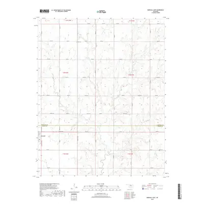
2018 Map of Marshall East
USGS Topo · Published 2018About this map
The town of Marshall anchors this Oklahoma landscape at the intersection of Logan and Garfield Counties. The area is defined by a dense network of watercourses, where Otter Creek and its many tributaries, including Crows Nest Cr and Four D Cr, carve a intricate drainage pattern through the agricultural sections. A small body of water, Shell Lake, sits tucked between the township lines in the eastern portion of the survey.
Find a feature on this map
50 named features on this map. Tap any name to fly to it.
Don’t see what you’re looking for? This feature index may not catch every label — zoom into the map to look around manually.
Map Details
Editions of this 2018 Marshall East Map
This is the sole edition of this map. No revisions or reprints were ever made.
Other maps of this area

1893 · Mulhall
USGS Topo · 1:62,500

1893 · Lovell
USGS Topo · 1:62,500

1955 · Enid
USGS Topo · 1:250,000

1956 · Garber
USGS Topo · 1:62,500

1958 · Enid
USGS Topo · 1:250,000

1972 · Lucien
USGS Topo · 1:24,000
1974 · Mulhall
USGS Topo · 1:24,000

1974 · Marshall West
USGS Topo · 1:24,000

1974 · Marshall East
USGS Topo · 1:24,000
1974 · Bridge Creek
USGS Topo · 1:24,000