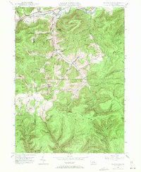
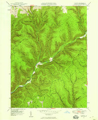
1947 Map of Marshlands
USGS Topo · Published 1970About this map
Pine Creek serves as the central artery for this late-1940s landscape, where the Baltimore and Ohio railroad and the Roosevelt Highway parallel the water through the northern valley. Small riverside settlements like Watrous, Phoenix, and Manhattan define the local economy of the era, while the upland areas toward Cedar Mountain are marked by a complex network of forest trails and hollows. The presence of a Gas Well in the northern hills suggests the region's mid-century energy exploration.
Find a feature on this map
38 named features on this map. Tap any name to fly to it.
Don’t see what you’re looking for? This feature index may not catch every label — zoom into the map to look around manually.
Map Details
Editions of this 1947 Marshlands Map
5 editions found

Other maps of this area

1899 · Gaines
USGS Topo · 1:62,500

1900 · Gaines
USGS Topo · 1:62,500

1900 · Elkland
USGS Topo · 1:62,500

1946 · Tiadaghton
USGS Topo · 1:24,000

1946 · Antrim
USGS Topo · 1:62,500

1946 · Cedar Run
USGS Topo · 1:24,000

1947 · Galeton
USGS Topo · 1:62,500

1947 · Lee Fire Tower
USGS Topo · 1:24,000
1947 · Oleona
USGS Topo · 1:24,000

1947 · Galeton
USGS Topo · 1:24,000
Featured Places
- Gaines Township, PA
- Abbott Township, PA
- Pike Township, PA
- West Branch Township, PA
- Manhattan, Gaines Township