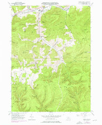
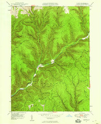
1947 Map of Marshlands
USGS Topo · Published 1976About this map
Pine Creek carves a significant corridor through the Pennsylvania highlands, anchoring a landscape where narrow valleys are named for the families who settled them. The small communities of Gaines, Watrous, and Marshlands follow the river's path, serving as local centers for an economy tied to the timbered hills and a burgeoning energy sector, evidenced by the Gas Well near Hedgehog Point. In the mid-century era, local life centered around rural landmarks like the Maynard Sch and Phoenix Cem, while the industrial past is preserved in place names such as Acid Factory Hollow. The terrain is crisscrossed by established paths like the Switchback Trail and Rexford Trail, reflecting the transition from early resource extraction to recreational use. Dozens of named drainage features, from Bloody Run to Water Trough Run, define the complex topography that separates the Elk and Pine Creek watersheds.
Find a feature on this map
88 named features on this map. Tap any name to fly to it.
Don’t see what you’re looking for? This feature index may not catch every label — zoom into the map to look around manually.
Map Details
Editions of this 1947 Marshlands Map
5 editions found

Other maps of this area

1899 · Gaines
USGS Topo · 1:62,500

1900 · Gaines
USGS Topo · 1:62,500

1900 · Elkland
USGS Topo · 1:62,500

1946 · Tiadaghton
USGS Topo · 1:24,000

1946 · Antrim
USGS Topo · 1:62,500

1946 · Cedar Run
USGS Topo · 1:24,000

1947 · Galeton
USGS Topo · 1:62,500

1947 · Lee Fire Tower
USGS Topo · 1:24,000
1947 · Oleona
USGS Topo · 1:24,000

1947 · Galeton
USGS Topo · 1:24,000
Featured Places
- Gaines Township, PA
- Abbott Township, PA
- Pike Township, PA
- West Branch Township, PA
- Manhattan, Gaines Township