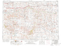
1955 Map of Martin
USGS Topo · Published 1976About this map
The Pine Ridge Indian Reservation and Rosebud Indian Reservation dominate this mid-century landscape of south-central South Dakota, where tribal lands meet the distinctive geology of the Little Badlands. The map illustrates a transportation network defined by the Chicago Milwaukee St Paul and Pacific railroad in the north, serving towns like Murdo and Presho, and the Chicago and North Western running through the south near Martin.
Find a feature on this map
90 named features on this map. Tap any name to fly to it.
Don’t see what you’re looking for? This feature index may not catch every label — zoom into the map to look around manually.
Map Details
Editions of this 1955 Martin Map
2 editions found

Other maps of this area

1950 · Norden
USGS Topo · 1:62,500

1950 · Interior
USGS Topo · 1:24,000

1950 · Interior SE
USGS Topo · 1:24,000

1950 · Sparks
USGS Topo · 1:62,500

1950 · Potato Creek
USGS Topo · 1:24,000

1950 · Wanblee
USGS Topo · 1:24,000

1950 · Kilgore
USGS Topo · 1:62,500

1950 · Weta
USGS Topo · 1:24,000

1950 · Valentine
USGS Topo · 1:62,500

1950 · Cody
USGS Topo · 1:62,500