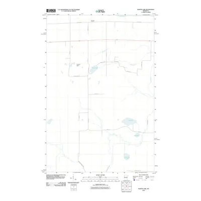
2010 Map of Martin Lake
USGS Topo · Published 2010About this map
The Saint Louis River defines the northern reaches of this landscape in Carlton County, marking a terrain of scattered glacial lakes and wetlands at the start of the 21st century. The interior is largely defined by water bodies such as Martin Lake, Lost Lake, and Hardwood Lake, which are interconnected by drainages like Martin Branch and Stoney Brook. Human settlement is sparsely distributed along a grid of rural roads, including McCamus Rd and Brandon Rd. Notable landmarks for local history and navigation include the Arrowhead Cemetery and the Arrowhead Lookout Tower, positioned in the northern half of the quadrangle. This layout reveals a region primarily dedicated to forestry or conservation, where the infrastructure is built around the natural flow of the waterways and the management of the surrounding timberland.
Find a feature on this map
23 named features on this map. Tap any name to fly to it.
Don’t see what you’re looking for? This feature index may not catch every label — zoom into the map to look around manually.
Map Details
Editions of this 2010 Martin Lake Map
This is the sole edition of this map. No revisions or reprints were ever made.
Other maps of this area

1953 · Alborn
USGS Topo · 1:24,000

1953 · Brookston
USGS Topo · 1:24,000

1953 · Brookston NW
USGS Topo · 1:24,000

1953 · Duluth
USGS Topo · 1:250,000

1954 · Iverson
USGS Topo · 1:24,000

1954 · Sawyer
USGS Topo · 1:24,000

1954 · Martin Lake
USGS Topo · 1:24,000

1956 · Barnum
USGS Topo · 1:62,500

1958 · Duluth
USGS Topo · 1:250,000

1961 · Cromwell
USGS Topo · 1:62,500
Featured Places
- North Carlton, MN
- Perch Lake Township, MN
- Stoney Brook Township, MN
- Saint Louis County, MN
- Carlton County, MN