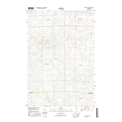
2016 Map of Martin Lake
USGS Topo · Published 2016About this map
The northern reaches of Carlton County and southern St. Louis County meet in this 2016 survey of the Minnesota backcountry. The landscape is defined by its hydrology and thick timber, where the Saint Louis River flows along the northern edge of the map. Central to the area is Martin Lake, feeding into the winding Martin Br. The map reveals a network of local forest roads such as Maki Rd and Arrowhead Forrest Rd that carve through the wetlands. A significant historical anchor for the local community is the Arrowhead Cem located near the northern boundary. Further south, the terrain becomes increasingly marshy, punctuated by bodies of water like Lost Lake, Side Lake, and Hardwood Lake, showing the glacial character of the region.
Find a feature on this map
35 named features on this map. Tap any name to fly to it.
Don’t see what you’re looking for? This feature index may not catch every label — zoom into the map to look around manually.
Map Details
Editions of this 2016 Martin Lake Map
This is the sole edition of this map. No revisions or reprints were ever made.
Other maps of this area

1953 · Alborn
USGS Topo · 1:24,000

1953 · Brookston
USGS Topo · 1:24,000

1953 · Brookston NW
USGS Topo · 1:24,000

1953 · Duluth
USGS Topo · 1:250,000

1954 · Iverson
USGS Topo · 1:24,000

1954 · Sawyer
USGS Topo · 1:24,000

1954 · Martin Lake
USGS Topo · 1:24,000

1956 · Barnum
USGS Topo · 1:62,500

1958 · Duluth
USGS Topo · 1:250,000

1961 · Cromwell
USGS Topo · 1:62,500
Featured Places
- North Carlton, MN
- Perch Lake Township, MN
- Stoney Brook Township, MN
- Saint Louis County, MN
- Carlton County, MN