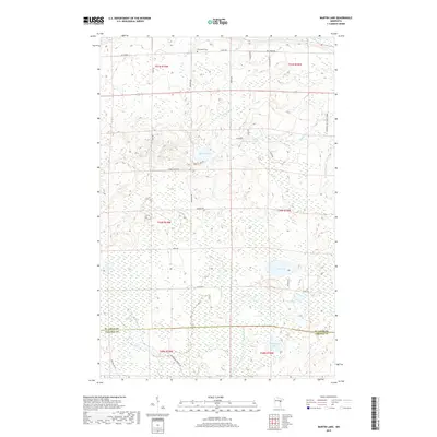
2019 Map of Martin Lake
USGS Topo · Published 2019About this map
The county line between St. Louis Co Carlton Co bisects this landscape of glacial wetlands and interconnected waterways in Northern Minnesota. Central to the area is Martin Lake, which feeds into Martin Br and eventually connects to the drainage of Stoney Brook. The map reveals a network of rural routes named for local families and settlers, including Maki Rd, Brandon Rd, and Christiansen Rd, suggesting a history of land allotment and homesteading in the townships of t50n r19w and t51n r19w. To the north, Arrowhead Cem serves as a significant genealogical landmark for researchers of the region's rural communities. Large tracts of marsh and bog surround southern water bodies like Lost Lake, Side Lake, and Hardwood Lake, illustrating the difficult terrain that dictated the placement of early logging roads and modern improvements such as Arrowhead Forrest Rd.
Find a feature on this map
33 named features on this map. Tap any name to fly to it.
Don’t see what you’re looking for? This feature index may not catch every label — zoom into the map to look around manually.
Map Details
Editions of this 2019 Martin Lake Map
This is the sole edition of this map. No revisions or reprints were ever made.
Other maps of this area

1953 · Alborn
USGS Topo · 1:24,000

1953 · Brookston
USGS Topo · 1:24,000

1953 · Brookston NW
USGS Topo · 1:24,000

1953 · Duluth
USGS Topo · 1:250,000

1954 · Iverson
USGS Topo · 1:24,000

1954 · Sawyer
USGS Topo · 1:24,000

1954 · Martin Lake
USGS Topo · 1:24,000

1956 · Barnum
USGS Topo · 1:62,500

1958 · Duluth
USGS Topo · 1:250,000

1961 · Cromwell
USGS Topo · 1:62,500
Featured Places
- North Carlton, MN
- Perch Lake Township, MN
- Stoney Brook Township, MN
- Saint Louis County, MN
- Carlton County, MN