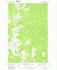
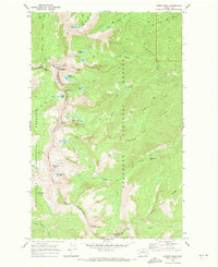
1969 Map of Martin Peak
USGS Topo · Published 1980About this map
Sawtooth Ridge forms a high-altitude spine through this alpine landscape, marking the rugged boundary between the Okanogan National Forest and Wenatchee National Forest. Based on 1967 aerial photography and field-checked in 1969, the survey documents a complex network of high-country drainage and glacially carved basins. To the west, the headwaters of Prince Creek and its branches flow toward the Columbia River watershed, while the eastern slopes feed the Libby Creek and Gold Creek systems.
Find a feature on this map
41 named features on this map. Tap any name to fly to it.
Don’t see what you’re looking for? This feature index may not catch every label — zoom into the map to look around manually.
Map Details
Editions of this 1969 Martin Peak Map
2 editions found
Other maps of this area

1899 · Methow
USGS Topo · 1:125,000

1901 · Methow
USGS Topo · 1:125,000

1955 · Concrete
USGS Topo · 1:250,000

1958 · Concrete
USGS Topo · 1:250,000

1962 · Concrete
USGS Topo · 1:250,000

1968 · South Navarre Peak
USGS Topo · 1:24,000
1968 · Big Goat Mtn
USGS Topo · 1:24,000
1968 · Oss Peak
USGS Topo · 1:24,000
1968 · Hungry Mtn
USGS Topo · 1:24,000
1969 · Martin Peak
USGS Topo · 1:24,000