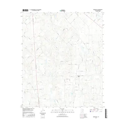
2016 Map of Martins Mill
USGS Topo · Published 2016About this map
Martins Mill serves as the primary hub of this East Texas landscape, where a dense network of county roads intersects with S Trade Days Blvd. The geography is defined by a dendritic drainage system of creeks and small impoundments, with Kickapoo Cr and Grand Saline Cr cutting through the terrain. For those tracing family histories in Van Zandt County, the map provides precise locations for the Carter Cem and Cox Cem, which are situated among the woodlots and small lakes of the area. The local hydrology is marked by several named water bodies, including Alexander Lake, Lowrie Lake, and Dubose Lake, illustrating how the region's residents have managed the flow of tributaries like Cream Level Cr and Alligator Cr.
Find a feature on this map
77 named features on this map. Tap any name to fly to it.
Don’t see what you’re looking for? This feature index may not catch every label — zoom into the map to look around manually.
Map Details
Editions of this 2016 Martins Mill Map
This is the sole edition of this map. No revisions or reprints were ever made.
Other maps of this area

1948 · Brownsboro
USGS Topo · 1:62,500

1948 · Martins Mill
USGS Topo · 1:62,500

1949 · Martins Mill
USGS Topo · 1:62,500

1949 · Brownsboro
USGS Topo · 1:62,500

1956 · Tyler
USGS Topo · 1:250,000

1959 · Van
USGS Topo · 1:24,000

1959 · Grand Saline
USGS Topo · 1:62,500

1962 · Myrtle Springs
USGS Topo · 1:24,000
1962 · Canton
USGS Topo · 1:24,000

1984 · Tyler
USGS Topo · 1:250,000