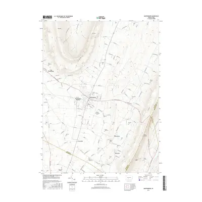
2016 Map of Martinsburg
USGS Topo · Published 2016About this map
Martinsburg and its surrounding agricultural valleys sit tucked between the steep ridges of Loop Mtn and Tussey Mountain. This 2016 survey shows a landscape heavily marked by family and community heritage, with nearly twenty named cemeteries scattered across the township, including the Diehls Crossroads Brethren Cem and Rebecca Furnace Cem. The settlement pattern follows the valley floors, where Curryville and Henrietta anchor the southern reaches, and Martinsburg Junction indicates the historical importance of rail transit in the area.
Find a feature on this map
131 named features on this map. Tap any name to fly to it.
Don’t see what you’re looking for? This feature index may not catch every label — zoom into the map to look around manually.
Map Details
Editions of this 2016 Martinsburg Map
This is the sole edition of this map. No revisions or reprints were ever made.
Other maps of this area

1900 · Everett
USGS Topo · 1:62,500

1901 · Huntingdon
USGS Topo · 1:62,500

1902 · Everett
USGS Topo · 1:62,500

1902 · Hollidaysburg
USGS Topo · 1:62,500

1903 · Hollidaysburg
USGS Topo · 1:62,500

1904 · Huntingdon
USGS Topo · 1:62,500

1930 · Broad Top
USGS Topo · 1:62,500

1933 · Broad Top
USGS Topo · 1:62,500

1953 · Pittsburgh
USGS Topo · 1:250,000

1954 · Pittsburgh
USGS Topo · 1:250,000
Featured Places
- Frankstown Township, PA
- Martinsburg, PA
- Martinsburg Junction, North Woodbury Township
- Woodbury Township, PA
- Taylor Township, PA