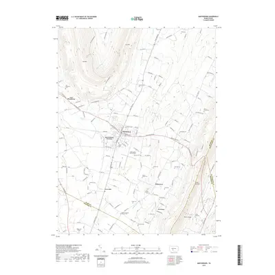
2019 Map of Martinsburg
USGS Topo · Published 2019About this map
Martinsburg serves as the central hub of this agricultural and aviation landscape in Blair County, where the valley floor is punctuated by numerous family and denominational burial grounds. The presence of the Altoona-Blair County Airport and the smaller Baker-Sell Airport highlights the importance of regional aviation, while the Martinsburg Junction rail point indicates the area's historical transportation connectivity.
Find a feature on this map
145 named features on this map. Tap any name to fly to it.
Don’t see what you’re looking for? This feature index may not catch every label — zoom into the map to look around manually.
Map Details
Editions of this 2019 Martinsburg Map
This is the sole edition of this map. No revisions or reprints were ever made.
Other maps of this area

1900 · Everett
USGS Topo · 1:62,500

1901 · Huntingdon
USGS Topo · 1:62,500

1902 · Everett
USGS Topo · 1:62,500

1902 · Hollidaysburg
USGS Topo · 1:62,500

1903 · Hollidaysburg
USGS Topo · 1:62,500

1904 · Huntingdon
USGS Topo · 1:62,500

1930 · Broad Top
USGS Topo · 1:62,500

1933 · Broad Top
USGS Topo · 1:62,500

1953 · Pittsburgh
USGS Topo · 1:250,000

1954 · Pittsburgh
USGS Topo · 1:250,000
Featured Places
- Frankstown Township, PA
- Martinsburg, PA
- Martinsburg Junction, North Woodbury Township
- Woodbury Township, PA
- Taylor Township, PA