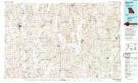
1986 Map of Maryville
USGS Topo · Published 1994About this map
Maryville serves as the primary regional hub in this mid-1980s portrait of Northwest Missouri, anchored by the campus of Northwest Missouri State University. The landscape is defined by its deep-set river valleys, where the Platte River, the One Hundred and Two River, and the Grand River carve southward through a patchwork of agricultural townships. Transportation corridors like U.S. 71 and U.S. 136 connect numerous smaller prairie settlements, including Stanberry, Albany, and Bethany.
Find a feature on this map
112 named features on this map. Tap any name to fly to it.
Don’t see what you’re looking for? This feature index may not catch every label — zoom into the map to look around manually.
Map Details
Editions of this 1986 Maryville Map
2 editions found
Other maps of this area

1885 · Atchison
USGS Topo · 1:125,000

1888 · Atchison
USGS Topo · 1:125,000

1893 · Atchison
USGS Topo · 1:125,000

1922 · Gallatin
USGS Topo · 1:62,500

1923 · Clarksdale
USGS Topo · 1:62,500

1923 · Maysville
USGS Topo · 1:62,500

1924 · Winston
USGS Topo · 1:62,500

1924 · St. Joseph
USGS Topo · 1:62,500

1925 · Pattonsburg
USGS Topo · 1:62,500

1925 · Clarksdale
USGS Topo · 1:62,500