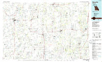
1986 Map of Maryville
USGS Topo · Published 1986About this map
Northwest Missouri State University anchors the western edge of this northwest Missouri landscape, situated in the city of Maryville. The region is defined by a dense network of river systems, including the Nodaway River, One Hundred and Two River, and Platte River, which flow south across the fertile plains of Empire Prairie. This mid-1980s data illustrates the agricultural character of the territory, where small farming hubs like Bethany, Stanberry, and Grant City serve as regional centers.
Find a feature on this map
264 named features on this map. Tap any name to fly to it.
Don’t see what you’re looking for? This feature index may not catch every label — zoom into the map to look around manually.
Map Details
Editions of this 1986 Maryville Map
2 editions found
Other maps of this area

1885 · Atchison
USGS Topo · 1:125,000

1888 · Atchison
USGS Topo · 1:125,000

1893 · Atchison
USGS Topo · 1:125,000

1922 · Gallatin
USGS Topo · 1:62,500

1923 · Clarksdale
USGS Topo · 1:62,500

1923 · Maysville
USGS Topo · 1:62,500

1924 · Winston
USGS Topo · 1:62,500

1924 · St. Joseph
USGS Topo · 1:62,500

1925 · Pattonsburg
USGS Topo · 1:62,500

1925 · Clarksdale
USGS Topo · 1:62,500