
1906 Map of Mason
USGS Topo · Published 1939About this map
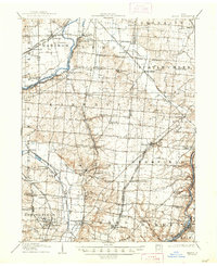
Union Village and Shaker Village anchor the rural landscape of Warren and Butler counties during this early twentieth-century survey. The region is defined by a dense network of early transportation, where the Miami River and Little Miami River are paralleled by competing rail interests. Lines like the Cincinnati Hamilton and Dayton RR and the Detroit Line cut through growing towns such as Mason and Trenton, while several electric lines, including the Cincinnati and Dayton Electric RR, suggest a rapidly connecting hinterland. The presence of numerous post offices, such as Amanda Excello P O and Lemon P O, highlights the importance of these small hubs for early mail delivery. Industry is notably represented by Kings Mills on the river, and the diverse names like Blueball and Le Sourdsville provide a clear view of local settlement patterns before modern suburban expansion.
Find a feature on this map
95 named features on this map. Tap any name to fly to it.
Don’t see what you’re looking for? This feature index may not catch every label — zoom into the map to look around manually.
Map Details
Editions of this 1906 Mason Map
2 editions found
Other maps of this area

1898 · East Cincinnati
USGS Topo · 1:62,500

1904 · Mason
USGS Topo · 1:62,500

1908 · Miamisburg
USGS Topo · 1:62,500

1911 · Oxford
USGS Topo · 1:62,500

1913 · Waynesville
USGS Topo · 1:62,500

1914 · East Cincinnati
USGS Topo · 1:62,500

1914 · West Cincinnati
USGS Topo · 1:62,500

1914 · Batavia
USGS Topo · 1:48,000

1914 · Morrow
USGS Topo · 1:62,500

1915 · Hamilton
USGS Topo · 1:62,500