
1951 Map of Mason City SW
USGS Topo · Published 1953About this map
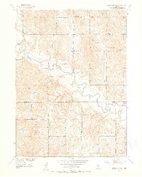
The South Loup River meanders across this rural landscape at the intersection of Custer, Buffalo, and Dawson Counties, anchoring a region defined by its narrow valleys and dissected uplands. This early 1950s survey captures a network of rural schoolhouses that once served these agrarian communities, including Sunny Slope Sch, Flat Bottom Sch, and Victory Hill Sch. The small settlement of Cumro sits near Box Elder Creek in the northwest, while the Milton Store serves as a localized landmark along the river in the southeast. This map illustrates the transition from the river bottomlands to the headwaters of the Wood River system. The presence of a Gaging Sta and various creek branches like Elk Creek and Cat Creek suggests the importance of water management and livestock grazing in this central Nebraska territory.
Find a feature on this map
23 named features on this map. Tap any name to fly to it.
Don’t see what you’re looking for? This feature index may not catch every label — zoom into the map to look around manually.
Map Details
Editions of this 1951 Mason City SW Map
3 editions found
Other maps of this area

1896 · Lexington
USGS Topo · 1:125,000

1896 · Kearney
USGS Topo · 1:125,000

1899 · Lexington
USGS Topo · 1:125,000

1951 · Eddyville NE
USGS Topo · 1:24,000

1951 · Eddyville
USGS Topo · 1:24,000

1951 · Mason City NW
USGS Topo · 1:24,000

1951 · Mason City
USGS Topo · 1:24,000

1951 · Mason City SE
USGS Topo · 1:24,000

1955 · Broken Bow
USGS Topo · 1:250,000

1955 · Grand Island
USGS Topo · 1:250,000