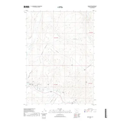
2017 Map of Mason Draw
USGS Topo · Published 2017About this map
Dubois sits at the confluence of several major waterways, marking a vital transition point where the high peaks of the Absaroka Range meet the river basin. The Wind River flows through the southern section of the quadrangle, joined by tributaries like Jakeys Fork and Torrey Cr. This 2017 survey details the residential street network of Dubois, including Leseberg Ave and Painted Hills Dr, showing the town's modern footprint against the dramatic relief of Table Mtn and Windy Ridge. To the north, the landscape is defined by vast drainage systems like Mason Draw and Pease Draw, while access routes such as EA Ranch Rd and the Nat'l Elk Grnd Access Seasd highlight the region's ranching and conservation history. The map provides clear evidence of the area's geological and hydrological complexity, from the winding path of Wiggins Fork to the high-elevation draws that define the Fremont County backcountry.
Find a feature on this map
36 named features on this map. Tap any name to fly to it.
Don’t see what you’re looking for? This feature index may not catch every label — zoom into the map to look around manually.
Map Details
Editions of this 2017 Mason Draw Map
This is the sole edition of this map. No revisions or reprints were ever made.
Other maps of this area

1904 · Kirwin
USGS Topo · 1:125,000

1905 · Younts Peak
USGS Topo · 1:125,000

1906 · Kirwin
USGS Topo · 1:125,000

1907 · Younts Peak
USGS Topo · 1:125,000

1909 · Fremont Peak
USGS Topo · 1:125,000

1952 · Blue Holes
USGS Topo · 1:24,000

1955 · Thermopolis
USGS Topo · 1:250,000

1956 · Indian Point
USGS Topo · 1:24,000

1956 · Dubois
USGS Topo · 1:24,000

1956 · Ramshorn Peak
USGS Topo · 1:24,000