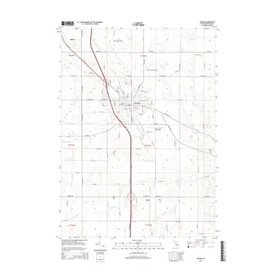
2014 Map of Mason
USGS Topo · Published 2014About this map
Mason and its surrounding Ingham County agricultural lands are defined by a complex network of man-made and natural water systems, including the Aurelius and Vevay Drain, Talmadge Drain, and Hazelton Drain. These irrigation and drainage projects, alongside winding water bodies like Sycamore Cr and North Br Willow Cr, supported the development of the region's productive farm country. The map shows the established settlement of Eden to the south and the southern edge of Holt in the northwest, connected by a dense grid of rural roads and the prominent path of N Cedar St. Aviation history is visible through three distinct landing strips, including Mason Jewett Field Airport, which sit among family-named burial grounds such as Maple Grove Cem, Eden Cem, and Rolfe Cem, providing valuable points of interest for genealogists tracing local families.
Find a feature on this map
89 named features on this map. Tap any name to fly to it.
Don’t see what you’re looking for? This feature index may not catch every label — zoom into the map to look around manually.
Map Details
Editions of this 2014 Mason Map
This is the sole edition of this map. No revisions or reprints were ever made.
Other maps of this area

1909 · Mason
USGS Topo · 1:62,500

1910 · Lansing
USGS Topo · 1:62,500

1911 · Mason
USGS Topo · 1:62,500

1912 · Lansing
USGS Topo · 1:62,500

1919 · Springport
USGS Topo · 1:62,500

1919 · Rives Junction
USGS Topo · 1:62,500

1921 · Rives Junction
USGS Topo · 1:62,500

1921 · Springport
USGS Topo · 1:62,500

1958 · Grand Rapids
USGS Topo · 1:250,000

1961 · Grand Rapids
USGS Topo · 1:250,000