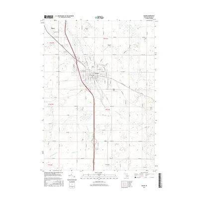
2017 Map of Mason
USGS Topo · Published 2017About this map
Mason serves as the central hub of this Ingham County landscape, where the street grid meets an extensive network of drainage systems and creeks. The hydrology of the region is defined by the winding path of Sycamore Creek and several managed waterways like Hazelton Drain, Talmadge Drain, and Aurelius and Vevay Drain. These features speak to the agricultural development of the area, while local aviation is represented by Mason Jewett Field, Sawyer Field, and Eichmeier Field. Genealogists will find significant value in the distribution of family and community burial grounds throughout the countryside, including Dubois Cem, Maple Grove Cem, Hawley Cem, and Rolfe Cem. To the south, the settlement of Eden sits near the junction of Eden Rd and W Barnes Rd, marking a distinct pocket of development within the broader township structure.
Find a feature on this map
112 named features on this map. Tap any name to fly to it.
Don’t see what you’re looking for? This feature index may not catch every label — zoom into the map to look around manually.
Map Details
Editions of this 2017 Mason Map
This is the sole edition of this map. No revisions or reprints were ever made.
Other maps of this area

1909 · Mason
USGS Topo · 1:62,500

1910 · Lansing
USGS Topo · 1:62,500

1911 · Mason
USGS Topo · 1:62,500

1912 · Lansing
USGS Topo · 1:62,500

1919 · Springport
USGS Topo · 1:62,500

1919 · Rives Junction
USGS Topo · 1:62,500

1921 · Rives Junction
USGS Topo · 1:62,500

1921 · Springport
USGS Topo · 1:62,500

1958 · Grand Rapids
USGS Topo · 1:250,000

1961 · Grand Rapids
USGS Topo · 1:250,000