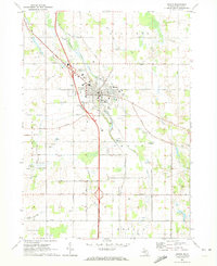
1970 Map of Mason
USGS Topo · Published 1973About this map
The city of Mason serves as the central hub of this 1970 survey, showcasing the organized street grid and vital community infrastructure of the Ingham County seat. The landscape is defined by the winding course of Sycamore Creek and its many tributaries, such as Willow Creek and Mud Creek, which are interspersed with agricultural fields and numerous active Gravel Pits. Significant transportation corridors include the Penn Central Railroad and several prominent local routes like Dexter Trail and Columbia Road.
Find a feature on this map
66 named features on this map. Tap any name to fly to it.
Don’t see what you’re looking for? This feature index may not catch every label — zoom into the map to look around manually.
Map Details
Editions of this 1970 Mason Map
This is the sole edition of this map. No revisions or reprints were ever made.
Other maps of this area

1909 · Mason
USGS Topo · 1:62,500

1910 · Lansing
USGS Topo · 1:62,500

1911 · Mason
USGS Topo · 1:62,500

1912 · Lansing
USGS Topo · 1:62,500

1919 · Springport
USGS Topo · 1:62,500

1919 · Rives Junction
USGS Topo · 1:62,500

1921 · Rives Junction
USGS Topo · 1:62,500

1921 · Springport
USGS Topo · 1:62,500

1958 · Grand Rapids
USGS Topo · 1:250,000

1961 · Grand Rapids
USGS Topo · 1:250,000