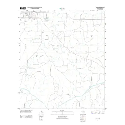
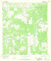
2012 Map of Mason
USGS Topo · Published 2012About this map
Mason serves as the primary hub of this Texas Hill Country terrain, characterized by a grid of local streets like College Ave and Post Hill St near the Fair Grounds Rd. The landscape transitions from the developed town center toward the south and east, where the winding Llano River cuts through the territory. Named heights such as Todd Mtn and Jordan Mtn provide vertical relief in an area defined by its intricate drainage network, including Comanche Creek and its many tributaries like Wolf Branch and Hog Branch. Small settlement clusters like Grossville appear along the roads connecting the rural ranch lands. This modern survey reflects the enduring cattle-country layout of the region, where older landmarks like Hick Springs and Old Mill Creek Rd persist alongside the Mason County Airport, illustrating the balance of historical land use and 21st-century infrastructure.
Find a feature on this map
60 named features on this map. Tap any name to fly to it.
Don’t see what you’re looking for? This feature index may not catch every label — zoom into the map to look around manually.
Map Details
Editions of this 2012 Mason Map
This is the sole edition of this map. No revisions or reprints were ever made.
Other maps of this area

1887 · Mason
USGS Topo · 1:125,000

1894 · Mason
USGS Topo · 1:125,000

1954 · Llano
USGS Topo · 1:250,000

1955 · Llano
USGS Topo · 1:250,000

1956 · Llano
USGS Topo · 1:250,000

1962 · Purdy Hill
USGS Topo · 1:24,000
1962 · Fly Gap
USGS Topo · 1:24,000
1967 · Loyal Valley
USGS Topo · 1:24,000
1967 · Panther Creek
USGS Topo · 1:24,000
1967 · Art
USGS Topo · 1:24,000