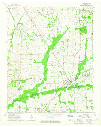
1965 Map of Mason
USGS Topo · Published 1966About this map
Mason and the surrounding borderlands of Tipton and Fayette Counties are defined by the low-lying wetlands of Baxter Bottom and the winding course of Beaver Creek. During the mid-1960s, the region's agricultural character remained strong, punctuated by numerous country churches and schools that served rural congregations, including Salem Ch, Trinity Ch, and the Braden-Sinai Sch. The Louisville and Nashville railroad cuts a diagonal path through the landscape, anchoring the settlements of Braden and Mason. Local history is deeply embedded in the terrain through small cemeteries like Cedar Hill Cem and Pipkins Cem, alongside established communities such as Charleston and Gainesville. The presence of several canals and the East Beaver Creek drainage system reflect ongoing efforts to manage the moist bottomlands for cultivation.
Find a feature on this map
38 named features on this map. Tap any name to fly to it.
Don’t see what you’re looking for? This feature index may not catch every label — zoom into the map to look around manually.
Map Details
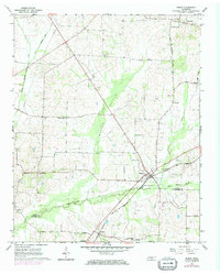
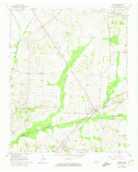
Editions of this 1965 Mason Map
3 editions found
Other maps of this area

1952 · Stanton
USGS Topo · 1:24,000

1952 · Lambert
USGS Topo · 1:24,000

1952 · Stanton
USGS Topo · 1:62,500

1954 · Mason
USGS Topo · 1:62,500

1956 · Blytheville
USGS Topo · 1:250,000

1959 · Blytheville
USGS Topo · 1:250,000

1961 · Rialto
USGS Topo · 1:62,500

1962 · Rialto
USGS Topo · 1:62,500
1964 · Turnpike
USGS Topo · 1:24,000

1965 · Brighton
USGS Topo · 1:24,000