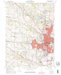
1961 Map of Massillon
USGS Topo · Published 1978About this map
The Tuscarawas River and the historic Ohio Canal corridor anchor this mid-century survey of western Stark County, revealing a landscape defined by industrial legacy and post-war suburban expansion. In the southeast, the expansive grounds of the Massillon State Hospital and Tiger Stadium Park mark the urban periphery of Massillon, while established neighborhoods like Sippo Heights and Kendall Heights fill the eastern hills. The map captures the complex rail network of the era, with the Penn Central, Baltimore and Ohio, and Norfolk and Western lines converging near the river.
Find a feature on this map
90 named features on this map. Tap any name to fly to it.
Don’t see what you’re looking for? This feature index may not catch every label — zoom into the map to look around manually.
Map Details
Editions of this 1961 Massillon Map
4 editions found
Other maps of this area

1901 · Massillon
USGS Topo · 1:62,500

1901 · Canton
USGS Topo · 1:62,500

1903 · Massillon
USGS Topo · 1:62,500

1903 · Canton
USGS Topo · 1:62,500

1912 · Dover
USGS Topo · 1:62,500

1914 · Navarre
USGS Topo · 1:62,500

1944 · Navarre
USGS Topo · 1:62,500

1944 · Dover
USGS Topo · 1:62,500

1951 · Canton
USGS Topo · 1:250,000

1951 · Bolivar
USGS Topo · 1:24,000