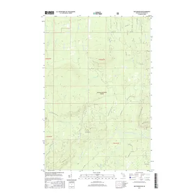
2017 Map of Matchwood NW
USGS Topo · Published 2017About this map
The Norwich Mine Site and its associated Norwich Cem anchor the southeastern corner of this map, representing the long-standing copper mining legacy of the Upper Peninsula. Situated within the Ottawa National Forest, the landscape is defined by the sharp elevations of the Trap Hills and a complex network of waterways, including the West Branch Ontonagon River and the Cranberry River. A segment of the N Country National Scenic Trail winds through these ridges, passing near Cascade Falls. The map reveals the intricate drainage patterns of the region through numerous named tributaries like Mendenhall Cr, Tolfrey Cr, and the Floodwood River, illustrating how the terrain was historically shaped by both geological forces and industrial extraction.
Find a feature on this map
54 named features on this map. Tap any name to fly to it.
Don’t see what you’re looking for? This feature index may not catch every label — zoom into the map to look around manually.
Map Details
Editions of this 2017 Matchwood NW Map
This is the sole edition of this map. No revisions or reprints were ever made.
Other maps of this area

1949 · Matchwood NW
USGS Topo · 1:24,000

1949 · White Pine
USGS Topo · 1:24,000

1949 · Bergland NE
USGS Topo · 1:24,000

1955 · Ontonagon
USGS Topo · 1:62,500

1956 · Bergland NE
USGS Topo · 1:24,000

1956 · Bergland
USGS Topo · 1:62,500

1956 · White Pine
USGS Topo · 1:24,000

1956 · Matchwood NW
USGS Topo · 1:24,000

1956 · White Pine
USGS Topo · 1:62,500

1956 · Matchwood
USGS Topo · 1:62,500