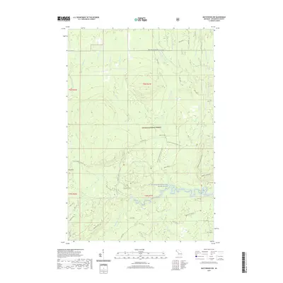
2019 Map of Matchwood NW
USGS Topo · Published 2019About this map
Norwich Mine Site and the nearby Norwich Cem anchor the southeastern corner of this map, representing the historical mining legacy in this part of the Upper Peninsula. Situated within the Ottawa National Forest, the landscape is defined by the high ridges of the Trap Hills and a dense network of watercourses. The Ontonagon Wild and Scenic River and its many tributaries, including the W Br Ontonagon River and Cranberry River, carve through the terrain, with Cascade Falls marking a significant drop in the West Branch.
Find a feature on this map
51 named features on this map. Tap any name to fly to it.
Don’t see what you’re looking for? This feature index may not catch every label — zoom into the map to look around manually.
Map Details
Editions of this 2019 Matchwood NW Map
This is the sole edition of this map. No revisions or reprints were ever made.
Other maps of this area

1949 · Matchwood NW
USGS Topo · 1:24,000

1949 · White Pine
USGS Topo · 1:24,000

1949 · Bergland NE
USGS Topo · 1:24,000

1955 · Ontonagon
USGS Topo · 1:62,500

1956 · Bergland NE
USGS Topo · 1:24,000

1956 · Bergland
USGS Topo · 1:62,500

1956 · White Pine
USGS Topo · 1:24,000

1956 · Matchwood NW
USGS Topo · 1:24,000

1956 · White Pine
USGS Topo · 1:62,500

1956 · Matchwood
USGS Topo · 1:62,500