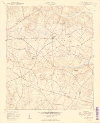
1950 Map of Matthews
USGS Topo · Published 1950About this map
The agrarian landscape of the Jefferson and Burke county border is captured in this mid-century survey, centered on the small village of Matthews. The area's social and educational life is anchored by landmarks like the Thomason Spring Hill Church and School and Atwell School, while numerous community spaces like the Camp Ground near Mt Moriah Church suggest a traditional rural gathering pattern.
Find a feature on this map
44 named features on this map. Tap any name to fly to it.
Don’t see what you’re looking for? This feature index may not catch every label — zoom into the map to look around manually.
Map Details
Editions of this 1950 Matthews Map
3 editions found

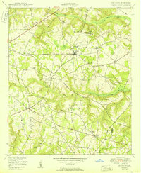
Other maps of this area

1919 · Gough
USGS Topo · 1:62,500

1920 · Stapleton
USGS Topo · 1:62,500

1922 · Harlem
USGS Topo · 1:62,500

1922 · Hephzibah
USGS Topo · 1:62,500

1948 · Hephzibah
USGS Topo · 1:62,500

1948 · Harlem
USGS Topo · 1:62,500

1948 · Stapleton
USGS Topo · 1:62,500

1948 · Gough
USGS Topo · 1:62,500

1948 · Blythe
USGS Topo · 1:24,000

1948 · Louisville
USGS Topo · 1:24,000