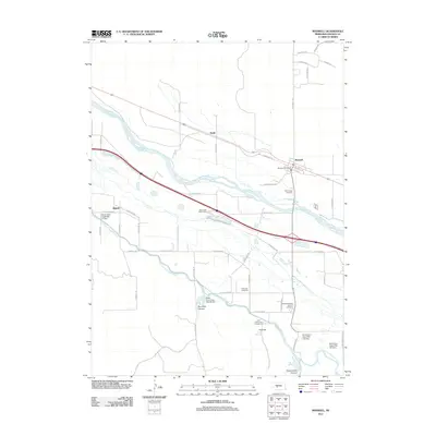
2011 Map of Maxwell
USGS Topo · Published 2011About this map
Fort McPherson National Cemetery stands as a significant landmark on the south side of the Platte River valley, anchoring this landscape of Nebraska prairie and irrigated farmland. The town of Maxwell is situated on the north bank, where the Maxwell Post Office and local streets like E 1st St define the settlement. The map reveals an intricate hydraulic system dominated by the Tri County Supply Canal, which winds through the terrain and feeds into several structures including the Earth Dam-Canal Mile 95 Dam and Ross Reservoir. Further south, the topography transitions into the deep cuts of Box Elder Canyon and Cottonwood Canyon. Small rural points of interest such as the McCullough Cemetery and the community of Bignell provide valuable reference points for those tracing local family lineages or studying the evolution of Lincoln County transportation and water management.
Find a feature on this map
51 named features on this map. Tap any name to fly to it.
Don’t see what you’re looking for? This feature index may not catch every label — zoom into the map to look around manually.
Map Details
Editions of this 2011 Maxwell Map
This is the sole edition of this map. No revisions or reprints were ever made.
Other maps of this area

1899 · North Platte
USGS Topo · 1:125,000

1902 · Gothenburg
USGS Topo · 1:125,000

1902 · North Platte
USGS Topo · 1:125,000

1954 · McCook
USGS Topo · 1:250,000

1954 · North Platte
USGS Topo · 1:250,000

1956 · North Platte
USGS Topo · 1:250,000

1956 · Wellfleet NW
USGS Topo · 1:24,000

1956 · Wellfleet NE
USGS Topo · 1:24,000

1957 · North Platte
USGS Topo · 1:250,000

1957 · McCook
USGS Topo · 1:250,000