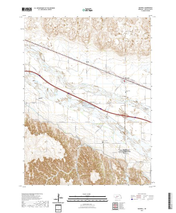
2021 Map of Maxwell
USGS Topo · Published 2021About this map
The Platte River corridor serves as the central artery of this Nebraska landscape, where the braided riverbed creates distinctive landforms like Brady Island and McCullough Island. The town of Maxwell sits at the northern edge of the valley, deeply tied to the Union Pacific railroad line that parallels the river. To the south, the terrain shifts dramatically from the flat alluvial plain into the dissected bluffs of Box Elder Canyon and Cottonwood Canyon, illustrating the transition between the river valley and the uplands.
Find a feature on this map
50 named features on this map. Tap any name to fly to it.
Don’t see what you’re looking for? This feature index may not catch every label — zoom into the map to look around manually.
Map Details
Editions of this 2021 Maxwell Map
This is the sole edition of this map. No revisions or reprints were ever made.
Other maps of this area

1899 · North Platte
USGS Topo · 1:125,000

1902 · Gothenburg
USGS Topo · 1:125,000

1902 · North Platte
USGS Topo · 1:125,000

1954 · McCook
USGS Topo · 1:250,000

1954 · North Platte
USGS Topo · 1:250,000

1956 · North Platte
USGS Topo · 1:250,000

1956 · Wellfleet NW
USGS Topo · 1:24,000

1956 · Wellfleet NE
USGS Topo · 1:24,000

1957 · North Platte
USGS Topo · 1:250,000

1957 · McCook
USGS Topo · 1:250,000