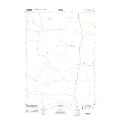
2011 Map of Mayhew Lake
USGS Topo · Published 2011About this map
Yaryan Ranch and Bufinch Ranch anchor this landscape of the Nebraska Sandhills, where large-scale cattle ranching defines the settlement pattern. In the early 21st century, the area remains dominated by open terrain and hydrology, with Big Creek winding across the northern half of the quadrangle. The map reveals the distinctive geography of Cherry County through features like Marsh Flat, located adjacent to the waters of Marsh Lake. These labels, alongside others like Starr Camp and Poole Flat, highlight the isolation and specialized land use in a region where named landmarks are often tied to specific ranching operations or localized topographic shifts.
Find a feature on this map
7 named features on this map. Tap any name to fly to it.
Don’t see what you’re looking for? This feature index may not catch every label — zoom into the map to look around manually.
Map Details
Editions of this 2011 Mayhew Lake Map
This is the sole edition of this map. No revisions or reprints were ever made.
Other maps of this area

1948 · Seneca
USGS Topo · 1:62,500

1948 · Mullen
USGS Topo · 1:62,500

1949 · Big Falls
USGS Topo · 1:62,500

1951 · Mullen
USGS Topo · 1:62,500

1951 · Seneca
USGS Topo · 1:62,500

1951 · Big Falls
USGS Topo · 1:62,500

1951 · Bull Lake
USGS Topo · 1:62,500

1957 · Valentine
USGS Topo · 1:250,000

1959 · Valentine
USGS Topo · 1:250,000

1985 · Mullen
USGS Topo · 1:100,000