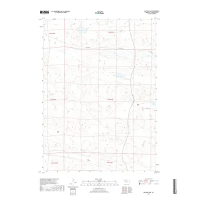
2017 Map of Mayhew Lake
USGS Topo · Published 2017About this map
Mayhew Lake sits amidst the characteristic Sandhills of Cherry County, defining a landscape shaped by shallow water bodies and expansive meadows. This 2017 survey by the U.S. Geological Survey illustrates the hydrological complexity of the region, where Little Steen Marsh and Marsh Lake exist alongside ephemeral terrain like Marsh Flat and Poole Flat. These features suggest a high water table typical of the Nebraska Sandhills, where drainage is often internal or directed toward slow-moving channels like Big Creek. Human presence is mapped through a sparse network of ranch roads, including W Big Creek Rd and Double R Dr, which navigate around the low-lying Dry Valley. The map's township and range divisions, such as t27n r32w, provide the essential legal framework for understanding land ownership and cattle ranching patterns in this distinct part of the Great Plains.
Find a feature on this map
17 named features on this map. Tap any name to fly to it.
Don’t see what you’re looking for? This feature index may not catch every label — zoom into the map to look around manually.
Map Details
Editions of this 2017 Mayhew Lake Map
This is the sole edition of this map. No revisions or reprints were ever made.
Other maps of this area

1948 · Seneca
USGS Topo · 1:62,500

1948 · Mullen
USGS Topo · 1:62,500

1949 · Big Falls
USGS Topo · 1:62,500

1951 · Mullen
USGS Topo · 1:62,500

1951 · Seneca
USGS Topo · 1:62,500

1951 · Big Falls
USGS Topo · 1:62,500

1951 · Bull Lake
USGS Topo · 1:62,500

1957 · Valentine
USGS Topo · 1:250,000

1959 · Valentine
USGS Topo · 1:250,000

1985 · Mullen
USGS Topo · 1:100,000