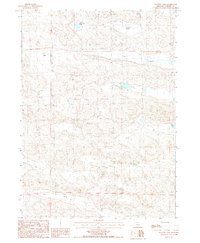
1987 Map of Mayhew Lake
USGS Topo · Published 1987About this map
The Nebraska Sandhills come into sharp focus in the late 1980s, revealing a landscape defined by ranching and vital water sources. Yaryan Ranch and the outlier camp at Starr Camp mark the sparse human footprint in this corner of Cherry County, where survival depends on the groundwater accessed through features like a Flowing Well and Irr Well.
Find a feature on this map
14 named features on this map. Tap any name to fly to it.
Don’t see what you’re looking for? This feature index may not catch every label — zoom into the map to look around manually.
Map Details
Editions of this 1987 Mayhew Lake Map
This is the sole edition of this map. No revisions or reprints were ever made.
Other maps of this area

1948 · Seneca
USGS Topo · 1:62,500

1948 · Mullen
USGS Topo · 1:62,500

1949 · Big Falls
USGS Topo · 1:62,500

1951 · Mullen
USGS Topo · 1:62,500

1951 · Seneca
USGS Topo · 1:62,500

1951 · Big Falls
USGS Topo · 1:62,500

1951 · Bull Lake
USGS Topo · 1:62,500

1957 · Valentine
USGS Topo · 1:250,000

1959 · Valentine
USGS Topo · 1:250,000

1985 · Mullen
USGS Topo · 1:100,000