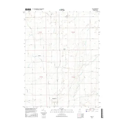
2016 Map of Mays
USGS Topo · Published 2016About this map
Rushville anchors the southern edge of this Rush County landscape, where the northern expansion of the city meets a grid of productive farmland. The terrain is defined by a dense network of watercourses, including the south-flowing Flatrock River and its various tributaries like Turkey Creek and Ben Davis Creek. This hydraulic pattern, supplemented by drainage works such as Newhouse Ditch and Henderson Ditch, reflects generations of agricultural land management in central Indiana.
Find a feature on this map
26 named features on this map. Tap any name to fly to it.
Don’t see what you’re looking for? This feature index may not catch every label — zoom into the map to look around manually.
Map Details
Editions of this 2016 Mays Map
This is the sole edition of this map. No revisions or reprints were ever made.
Other maps of this area

1948 · Lewisville
USGS Topo · 1:24,000

1950 · Dunreith
USGS Topo · 1:24,000

1950 · Lewisville
USGS Topo · 1:24,000

1953 · Cincinnati
USGS Topo · 1:250,000

1957 · Cincinnati
USGS Topo · 1:250,000

1959 · Rushville
USGS Topo · 1:24,000

1959 · New Salem
USGS Topo · 1:24,000

1959 · Mays
USGS Topo · 1:24,000

1959 · Falmouth
USGS Topo · 1:24,000
1960 · Manilla
USGS Topo · 1:24,000