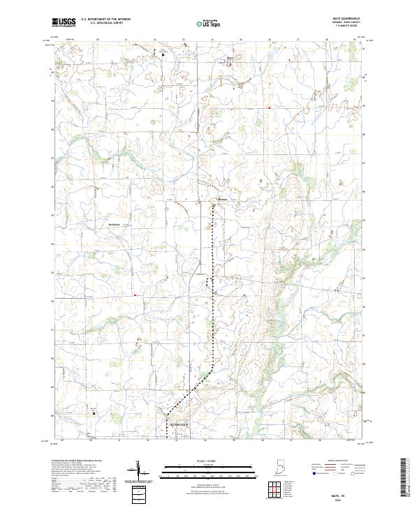
2022 Map of Mays
USGS Topo · Published 2022About this map
Agricultural patterns and water management define the landscape of northern Rush County, where the upper reaches of the Flatrock River and Little Blue River carve through the glacial till. Small crossroad settlements like Mays, Sexton, and Occident anchor the rural township grid, while the northern outskirts of Rushville appear at the southern margin. This area is characterized by an intricate network of drainage systems, including Henderson Ditch and Newhouse Ditch, which were essential for converting the local wetlands into productive farmland.
Find a feature on this map
79 named features on this map. Tap any name to fly to it.
Don’t see what you’re looking for? This feature index may not catch every label — zoom into the map to look around manually.
Map Details
Editions of this 2022 Mays Map
This is the sole edition of this map. No revisions or reprints were ever made.
Other maps of this area

1948 · Lewisville
USGS Topo · 1:24,000

1950 · Dunreith
USGS Topo · 1:24,000

1950 · Lewisville
USGS Topo · 1:24,000

1953 · Cincinnati
USGS Topo · 1:250,000

1957 · Cincinnati
USGS Topo · 1:250,000

1959 · Rushville
USGS Topo · 1:24,000

1959 · New Salem
USGS Topo · 1:24,000

1959 · Mays
USGS Topo · 1:24,000

1959 · Falmouth
USGS Topo · 1:24,000
1960 · Manilla
USGS Topo · 1:24,000