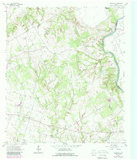
1962 Map of Maysfield
USGS Topo · Published 1989About this map
The Brazos River defines the eastern boundary of this Milam County landscape, winding through a patchwork of agricultural fields and rolling prairie. The settlement pattern reflects a deeply rooted rural community, anchored by the town of Maysfield and the smaller hub of Branchville. A notable concentration of community landmarks, such as the Maysfield Sch and Harlin Chapel, underscores the social fabric of the era. The land is dissected by numerous waterways including Hart Creek and String Prairie Branch, which historically dictated the placement of early homesteads.
Find a feature on this map
33 named features on this map. Tap any name to fly to it.
Don’t see what you’re looking for? This feature index may not catch every label — zoom into the map to look around manually.
Map Details
Editions of this 1962 Maysfield Map
2 editions found
Other maps of this area

1954 · Waco
USGS Topo · 1:250,000

1954 · Austin
USGS Topo · 1:250,000

1955 · Waco
USGS Topo · 1:250,000

1961 · Hanover
USGS Topo · 1:24,000

1961 · Cameron
USGS Topo · 1:24,000

1961 · Baileyville
USGS Topo · 1:24,000

1962 · Calvert
USGS Topo · 1:24,000

1962 · Maysfield
USGS Topo · 1:24,000

1962 · Rosebud
USGS Topo · 1:24,000

1962 · Hammond
USGS Topo · 1:24,000