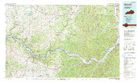
1991 Map of Maysville
USGS Topo · Published 1991About this map
The Ohio River acts as the central artery for this borderland, separating the steep, wooded hills of northern Kentucky from the diverse terrain of southern Ohio. In the early 1990s, the riverfront is anchored by Maysville, where the presence of Maysville Community College and Confidence Cemetery points to a long-established regional hub. Across the water, the landscape transitions into the extensive green space of Shawnee State Forest and the Tranquility State Wildlife Area, while smaller river towns like Ripley and Manchester remain tied to the valley's historic transportation corridor. Further inland, the map captures the transition to agricultural plateaus and rural townships, from West Union in Ohio to the river-bluff settlements of Vanceburg and Garrison in Kentucky. This edition documents the region's infrastructure before major modern shifts, showing the persistent rail lines of CSX Transportation and Norfolk Southern following the riverbanks.
Find a feature on this map
178 named features on this map. Tap any name to fly to it.
Don’t see what you’re looking for? This feature index may not catch every label — zoom into the map to look around manually.
Map Details
Editions of this 1991 Maysville Map
This is the sole edition of this map. No revisions or reprints were ever made.
Other maps of this area

1903 · Kenova
USGS Topo · 1:125,000

1904 · Kenova
USGS Topo · 1:125,000

1906 · Waverly
USGS Topo · 1:62,500

1908 · Waverly
USGS Topo · 1:62,500

1911 · Sciotoville
USGS Topo · 1:62,500

1913 · Sciotoville
USGS Topo · 1:62,500

1914 · Batavia
USGS Topo · 1:48,000

1915 · Bainbridge
USGS Topo · 1:48,000

1915 · Garrison
USGS Topo · 1:62,500

1915 · Otway
USGS Topo · 1:62,500