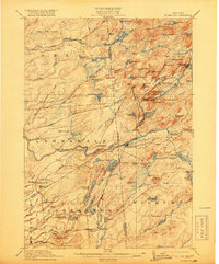
1912 Map of Mc Keever
USGS Topo · Published 1919About this map
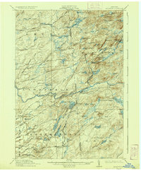
The New York Central and Hudson River Railroad follows the path of the Moose River through a landscape defined by industrial camps and early mountain travel. This survey, conducted just before the First World War, captures the Adirondack interior at a time when remote outposts like Becks Camp, Millards Camp, and Wakely Camp served as pivotal locations for forestry and recreation. The settlement of Mc Keever stands as a central hub at the junction of the rail line and the Adirondack Road, providing a glimpse into the logistics of the early 20th-century wilderness economy. Further south, established locales such as White Lake Corners and Porters Corners anchor the more settled edges of the quadrangle. The map is particularly dense with water features, from the expansive Big Otter Lake to the controlled waters at Coleman Dam, illustrating the intricate drainage network of the western Adirondack region.
Find a feature on this map
109 named features on this map. Tap any name to fly to it.
Don’t see what you’re looking for? This feature index may not catch every label — zoom into the map to look around manually.
Map Details
Editions of this 1912 Mc Keever Map
8 editions found

Other maps of this area

1897 · Remsen
USGS Topo · 1:62,500

1900 · Remsen
USGS Topo · 1:62,500

1900 · Wilmurt
USGS Topo · 1:62,500

1901 · Old Forge
USGS Topo · 1:62,500

1902 · Wilmurt
USGS Topo · 1:62,500

1903 · Big Moose
USGS Topo · 1:62,500

1904 · Boonville
USGS Topo · 1:62,500

1905 · Port Leyden
USGS Topo · 1:62,500

1907 · Port Leyden
USGS Topo · 1:62,500

1911 · Lowville
USGS Topo · 1:62,500