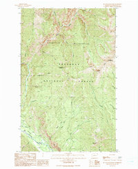
1991 Map of Mc Leod Mountain
USGS Topo · Published 1991About this map
McLeod Mountain and the high peaks of the Okanogan National Forest dominate this 1991 survey of north-central Washington. The terrain is defined by the sharp descent from the Pasayten Wilderness into the Methow Valley, where the Methow River flows past the Goat Wall. This provisional edition captures the landscape's transition from high alpine ridges like Setting Sun Mountain to the essential valley infrastructure, including the Lost River Landing Strip.
Find a feature on this map
31 named features on this map. Tap any name to fly to it.
Don’t see what you’re looking for? This feature index may not catch every label — zoom into the map to look around manually.
Map Details
Editions of this 1991 Mc Leod Mountain Map
This is the sole edition of this map. No revisions or reprints were ever made.
Other maps of this area

1920 · Slate Pass
USGS Topo · 1:125,000

1955 · Concrete
USGS Topo · 1:250,000

1958 · Concrete
USGS Topo · 1:250,000

1962 · Concrete
USGS Topo · 1:250,000

1962 · Mazama
USGS Topo · 1:62,500

1963 · Silver Star Mtn.
USGS Topo · 1:24,000
1963 · Robinson Mtn.
USGS Topo · 1:24,000

1969 · Lost Peak
USGS Topo · 1:24,000

1969 · Billy Goat Mtn
USGS Topo · 1:24,000
1969 · Mount Lago
USGS Topo · 1:24,000