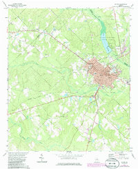
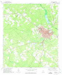
1972 Map of Mc Rae
USGS Topo · Published 1986About this map
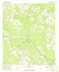
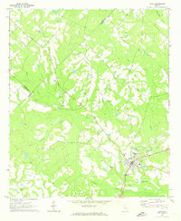
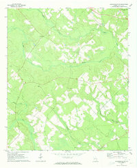
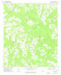
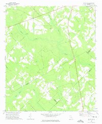
The adjacent railroad towns of McRae and Helena anchor this survey of the Georgia coastal plain, where the intersection of the Southern and Seaboard Coast Line railroads historically drove local commerce. The 1972 data, updated with mid-1980s purple-tinted revisions, shows a growing urban center characterized by civic landmarks like the City Hall, Library, and County Hospital. Outside the main town sites, the landscape follows the winding course of Sugar Creek and Gum Swamp Creek, with smaller settlements such as Achord appearing along the rail lines. Local heritage is preserved in sites like the Oak Grove Magnolia Cemetery and rural institutions including New Hope Ch. To the northeast, the Little Ocmulgee State Park provides a notable contrast to the surrounding agricultural and industrial plots, featuring a Golf Course, Campground, and Boat Landing on the Little Ocmulgee River.
Find a feature on this map
35 named features on this map. Tap any name to fly to it.
Don’t see what you’re looking for? This feature index may not catch every label — zoom into the map to look around manually.
Map Details
Editions of this 1972 Mc Rae Map
2 editions found
Other maps of this area

1953 · Waycross
USGS Topo · 1:250,000

1957 · Macon
USGS Topo · 1:250,000

1958 · Macon
USGS Topo · 1:250,000

1958 · Waycross
USGS Topo · 1:250,000

1964 · Macon
USGS Topo · 1:250,000
1970 · Scotland
USGS Topo · 1:24,000
1970 · Alamo
USGS Topo · 1:24,000
1971 · Jacksonville NE
USGS Topo · 1:24,000
1972 · Cooks Still
USGS Topo · 1:24,000
1972 · Mc Rae NW
USGS Topo · 1:24,000