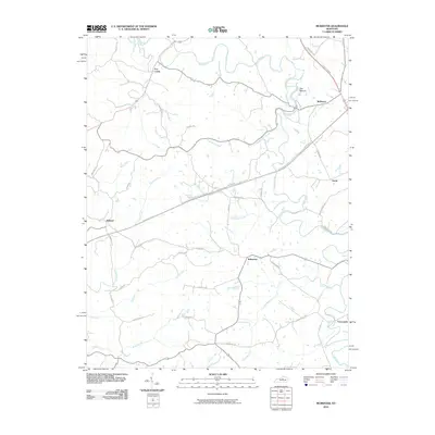
2010 Map of McBrayer
USGS Topo · Published 2010About this map
The Salt River winds through this central Kentucky landscape, carving a serpentine path past The Mound and the settlement of McBrayer. The terrain is defined by an intricate network of waterways, including Cheese Lick, Log Lick, and Buchanan Creek, which feed into the river system. This area reflects a traditional rural settlement pattern where small communities like Fox Creek, Ballard, and Nevin are connected by a web of local routes such as Dugansville Rd and Bardstown Rd. The modern infrastructure of the Bluegrass Pkwy cuts a straight line across these established drainage basins, juxtaposing late 20th-century transportation needs with the older, water-dependent geography of Kirkwood and Vanarsdell. This survey captures the region as the US Route 127 Bypass began to alter local traffic flow near the eastern edge of the quadrangle.
Find a feature on this map
42 named features on this map. Tap any name to fly to it.
Don’t see what you’re looking for? This feature index may not catch every label — zoom into the map to look around manually.
Map Details
Editions of this 2010 McBrayer Map
This is the sole edition of this map. No revisions or reprints were ever made.
Other maps of this area

1905 · Harrodsburg
USGS Topo · 1:125,000

1922 · Frankfort
USGS Topo · 1:48,000

1923 · Waddy
USGS Topo · 1:48,000

1924 · Frankfort
USGS Topo · 1:62,500

1925 · Mount Eden
USGS Topo · 1:48,000

1927 · Mount Eden
USGS Topo · 1:62,500

1951 · Lawrenceburg
USGS Topo · 1:24,000

1952 · Harrodsburg
USGS Topo · 1:24,000

1952 · Cornishville
USGS Topo · 1:24,000

1952 · Ashbrook
USGS Topo · 1:24,000