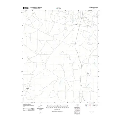
2010 Map of McBride
USGS Topo · Published 2010About this map
The High Plains landscape of Carson County is defined by its deep roots in the Texas petroleum and ranching industries. The Burnett Oil Field dominates the northeastern sector, supported by industrial outposts such as Burnett Camp and Carson Camp which reflect the specialized infrastructure required for local energy production. The settlement of Hillard sits at a critical intersection of the northern road network, while McBride anchors the southwestern corner of the sheet. Between these points, the land remains largely open, characterized by the expansive Sixtysix Sixtysix Ranch. Natural drainage follows the path of several watercourses, including the north-trending Hill Creek and the meandering Rock Creek. These riparian corridors, along with West Dixon Creek and Middle Dixon Creek, provide the essential water sources that have sustained both cattle and oil interests in this part of the Panhandle for generations.
Find a feature on this map
10 named features on this map. Tap any name to fly to it.
Don’t see what you’re looking for? This feature index may not catch every label — zoom into the map to look around manually.
Map Details
Editions of this 2010 McBride Map
This is the sole edition of this map. No revisions or reprints were ever made.
Other maps of this area

1939 · Sanford
USGS Topo · 1:62,500

1953 · Sanford
USGS Topo · 1:24,000

1953 · Deal
USGS Topo · 1:24,000

1953 · Borger SE
USGS Topo · 1:24,000

1953 · Pomeroy
USGS Topo · 1:24,000

1953 · McBride
USGS Topo · 1:24,000

1953 · Phillips
USGS Topo · 1:24,000

1953 · Borger
USGS Topo · 1:24,000

1954 · Amarillo
USGS Topo · 1:250,000

1958 · Amarillo
USGS Topo · 1:250,000