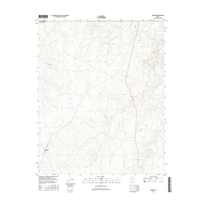
2016 Map of McBride
USGS Topo · Published 2016About this map
McBride sits in the southwestern reaches of this Panhandle landscape, where the flat high plains are deeply incised by a network of seasonal creek drainages. The area is defined by the boundary between Hutchinson Co and Carson Co, showing a region primarily dedicated to ranching and energy infrastructure. The topography is dominated by the erosion patterns of Rock Creek and the various branches of West Dixon Creek and Middle Dixon Creek, which carve rugged breaks into the otherwise level terrain. Human impact is evidenced by a grid of rural routes like Four Sixes Rd and industrial features such as Pipeline Rd, reflecting the dual economy of cattle and oil that has shaped this part of Texas for generations. The presence of Milner Rd and Huber St in the north suggests localized pockets of development near the county line.
Find a feature on this map
14 named features on this map. Tap any name to fly to it.
Don’t see what you’re looking for? This feature index may not catch every label — zoom into the map to look around manually.
Map Details
Editions of this 2016 McBride Map
This is the sole edition of this map. No revisions or reprints were ever made.
Other maps of this area

1939 · Sanford
USGS Topo · 1:62,500

1953 · Sanford
USGS Topo · 1:24,000

1953 · Deal
USGS Topo · 1:24,000

1953 · Borger SE
USGS Topo · 1:24,000

1953 · Pomeroy
USGS Topo · 1:24,000

1953 · McBride
USGS Topo · 1:24,000

1953 · Phillips
USGS Topo · 1:24,000

1953 · Borger
USGS Topo · 1:24,000

1954 · Amarillo
USGS Topo · 1:250,000

1958 · Amarillo
USGS Topo · 1:250,000