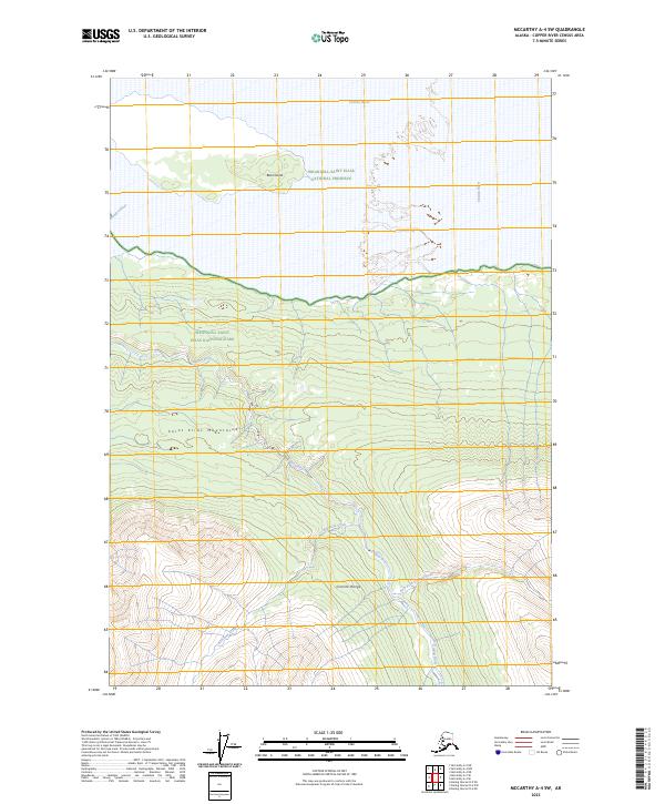
2023 Map of McCarthy A-4 SW
USGS Topo · Published 2023About this map
The Chitina River basin defines this remote landscape where several major protected regions meet. To the north, the Wrangell-Saint Elias National Preserve encompasses Bear Island within the braided river channel. South of the river, the terrain rises into the Saint Elias Mountains and the Granite Range, where the landscape transitions into the high-elevation Wrangell-Saint Elias National Park and the vast Wrangell-St. Elias Wilderness. This area is characterized by an intricate drainage system including the Kiagna River, its East Fork Kiagna River, and Bearhole Creek. The absence of roads or permanent settlements highlights the wilderness character of this portion of the Copper River Census Area, showing the preservation of the glacial and riverine environment in the early twenty-first century.
Find a feature on this map
15 named features on this map. Tap any name to fly to it.
Don’t see what you’re looking for? This feature index may not catch every label — zoom into the map to look around manually.
Map Details
Editions of this 2023 McCarthy A-4 SW Map
This is the sole edition of this map. No revisions or reprints were ever made.
Other maps of this area

1950 · Bering Glacier
USGS Topo · 1:250,000

1951 · McCarthy
USGS Topo · 1:250,000

1951 · Bering Glacier
USGS Topo · 1:250,000

1959 · McCarthy A-4
USGS Topo · 1:63,360

1959 · McCarthy A-5
USGS Topo · 1:63,360

1959 · Bering Glacier
USGS Topo · 1:250,000

1960 · McCarthy
USGS Topo · 1:250,000

1984 · Bering Glacier D-4
USGS Topo · 1:63,360

1984 · Bering Glacier D-5
USGS Topo · 1:63,360
1994 · McCarthy A-4
USGS Topo · 1:63,360