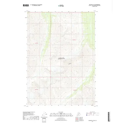
2017 Map of McCarthy A-6 SW
USGS Topo · Published 2017About this map
Wrangell-Saint Elias National Park preserves a vast mountain wilderness in the southeastern interior of Alaska, defined by the glacial waters of the Chakina River and its W Fork Chakina River. This 2017 topographic survey highlights a landscape dominated by dramatic elevation changes, with Goodlata Peak serving as a primary landmark in the center of the sheet. The drainage patterns of the river forks reveal the complex topography of this protected region, which remains largely untouched by modern road infrastructure. Public Land Survey System boundaries, such as t9s r12e and t10s r13e, divide the territory, providing a grid for researchers to locate specific natural features within the park's expansive boundaries.
Find a feature on this map
8 named features on this map. Tap any name to fly to it.
Don’t see what you’re looking for? This feature index may not catch every label — zoom into the map to look around manually.
Map Details
Editions of this 2017 McCarthy A-6 SW Map
This is the sole edition of this map. No revisions or reprints were ever made.
Other maps of this area

1950 · Bering Glacier
USGS Topo · 1:250,000

1951 · McCarthy
USGS Topo · 1:250,000

1951 · Bering Glacier
USGS Topo · 1:250,000

1959 · McCarthy A-6
USGS Topo · 1:63,360

1959 · Bering Glacier
USGS Topo · 1:250,000

1959 · McCarthy A-7
USGS Topo · 1:63,360

1960 · McCarthy
USGS Topo · 1:250,000
1984 · Bering Glacier D-7
USGS Topo · 1:63,360
1984 · Bering Glacier D-6
USGS Topo · 1:63,360

1994 · McCarthy A-6
USGS Topo · 1:63,360